
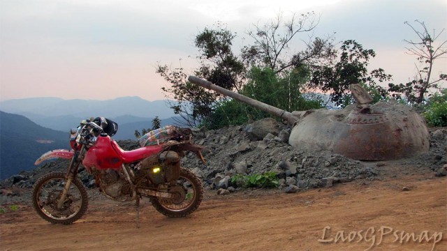
Any student of the Vietnam War knows about the Ho Chi Minh Trail. It was the series of roads, bridges, and supply dumps through which the North Vietnamese Army transported men and supplies from the North to South Vietnam. The majority of the Trail ran through Laos and Cambodia.
Thanks to a link posted on the CRFFL List (aka Cruffler List) I came across a site called Laos GPS Map. It had an extensive photo blog on what the Ho Chi Minh Trail looks like today. I found it extremely interesting and well worth 15 minutes of your time if you have any interest in the history of the Vietnam War.
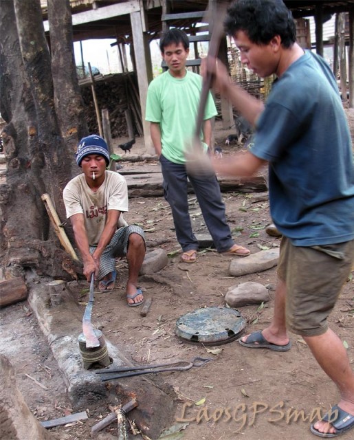
The Laotian villagers have become quite adept at using the metal scrap found for other purposes. In the picture below they are making a knife from steel remnants found along the Trail.
The author of the site sells a GPS map of Laos that works with Garmin GPS units. It includes unusual places of interest such as old NVA and Pathet Lao SAM sites. I dare say you won’t find those on most GPS maps! It also has the more mundane stuff such as Buddhist temples and the like.